Roadline - Sections Markers and Points
Roadline|Sections Markers and Points
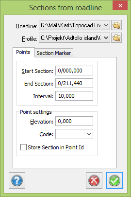
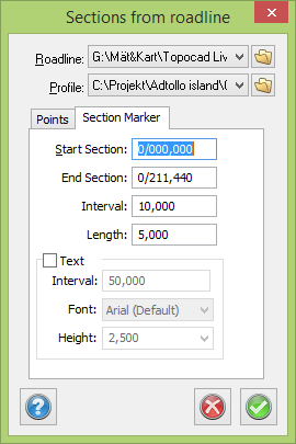
This command calculates sections along the road line. It is also possible to take the heights from a road profile if one has been selected. This feature is only available if you have the Longitudinal section module in Topocad. See Road line for more information about the format of the roadline. You can also create lines for a fixed interval and section information for another interval from the Section Marker tab.
To calculate sections along the road line:
- Select the layer where you want the created sections to appear.
- Select Sections Markers
- Select the roadline by clicking the Browse button.
- If necessary select the road profile by clicking the button in this row.
- Select the start and end sections from which you wish to calculate sections. Select the interval between sections.
- Specify whether the created points will use the default point code.
- Decide whether you want to use the point ID as the section. If so, tick the box.
- Click OK. The created sections will appear in the current layer.
TIP! The thousand meter separator can be selected in Roadlines.
TIP! The Point ID can be selected and displayed with the Point info command.
TIP! Selecting a symbol with a defined attribute for the Point ID means that the section is placed around that symbol.