Create contours
Drawing|Terrain||Contour
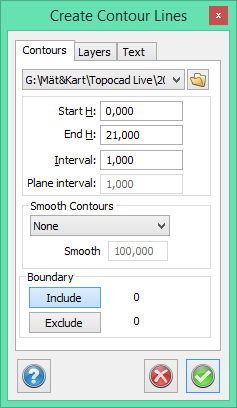
Contour lines will be created from a DTM or a point cloud with a selected interval. It is possible to split the elevations into separate layers for different levels. There are also various ways to smooth out the contours.
Model
Select the DTM/point cloud you want to create the contour lines from. By clicking on the drop-down arrow you can choose from the DTMs currently listed in the DTM manager. By clicking on the Browse button you can choose from all of the stored digital terrain models.
Interval
Enter a value for the interval you want to use to create the contour lines.
Plane interval
Determines how close it is between points in the point cloud. (1.000 = 1 m) The distance is important to get good contour lines and should be slightly larger than an overall distance of the point cloud.
Smooth contours
There are four ways to smooth out the contours. Three involve creating splines and one uses the radius. If using the radius you need to enter a factor. Anything between 50 and 400 is acceptable.
Layers
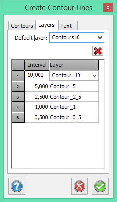
Default layer
You can select a default layer which is used for any elevation that does not have a specific layer.
Interval/Layer
Define which elevations are to be moved to a specific layer and name each layer. It is possible to use the default elevations and layer names.
Text
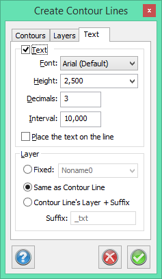
This command allows you to place text on the contour lines. Text is displayed at a specified interval along the contour line. Text can be placed either on or above the line.
See also
Text on contours
Create DTM
Modify DTM.