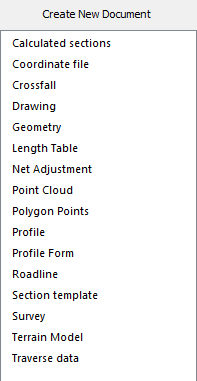
New document
Quick access toolbar|New
 Short key Ctrl+N
Function to create a new document in a new window. The following types of document can be created:
Calculated sections (.tcs)
The calculated sections are saved as this file type.
Coordinate file (.pxy)
This is a window for entering co-ordinate files in .pxy format. It is possible to import .pxy files into .top format, and export .top file to .pxy format, but other than this the two file types are not compatible.
Crossfall - Camber diagram (.tcf)
The camber settings can be saved in a file for use in the profile form etc...
Drawing (.top)
Creates a new drawing - this is the most important component of Topocad. It is a graphic view of the map and drawing. You can change to the text edit view from the graphic view. See also Default drawing
Length Table (.trll)
Length table used in railroad lines.
Net Adjustment (.tna)
The net adjustment is stored in a special file format.
Point Cloud (.tpc)
Point clouds is a document type for managing laser scanning data or other large amounts of points. Data can be imported from coordinate files (*.pxy, *.niv, *.tsd, *.tun), LAS files or by general import. Point clouds can be used instead of terrain models (*.DTM), in calculated sections and in the command Volume calculation between models.
Polygon Points - PP files (.pp)
This is a special kind of document in which polygon points can be entered. This file can be imported to and exported from the Topocad drawing format .top.
Profile (.trp)
Contains section and height data for road profiles.
Profile Form (.tpf)
The form for longitudinal sections and terrain longitudinal sections.
Roadlines (.trl)
Topocad Roadlines is the format for roadlines and they are created in this format. It is also possible to import the .trl format into Topocad drawings.
Section Templates (.tst)
This is used to build up road sections etc... to be used for volume calculations.
Survey (.sur)
A survey data document contains all of the survey data. This file type can be used to import files from different overall stations and to edit new survey data. When calculating survey data for co-ordinates, a drawing document will be needed and this can be created from the survey document.
Terrain Model - (.dtm)
Created digital terrain models.
Traverse data (.trv)
The traverse document contains all values relating to the traverse. The traverse can automatically load data from the Survey data file (.sur) or the data can be entered manually.