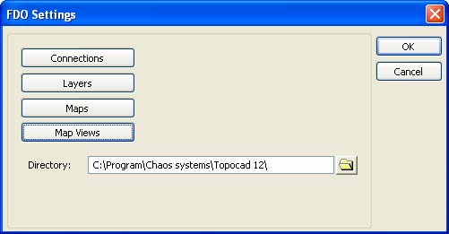
FDO settings
FDO|Settings
|
Command |
Description |
|
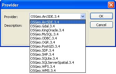
FDO uses a provider based model where each provider supports a certain format or data source. |
|
|
Settings for database. |
|
|
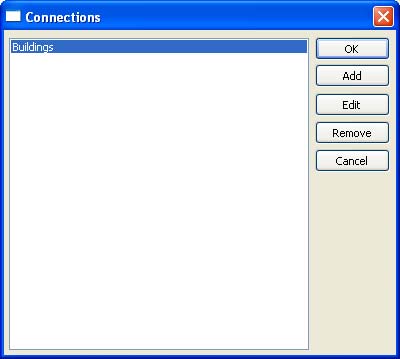
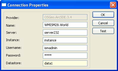
Configuration for connections to data sources. |
|
|
Configuration of connections between layers in Topocad and tables in the data source. |
|
|
Style settings for points. |
|
|
Style settings for lines and polygons. |
|
|
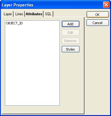
Configuration of the attributes that will be added to each object in the layer. |
|
|
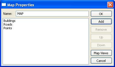
Configuration of the layers that will be added in a map, in which order they will be imported and map views concerning only this map. |
|
|
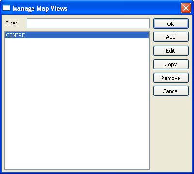
Configuration of global map views which can be used to open all maps in. |
Following providers are available
• ESRI ArcSDE
• MySQL
• SDF (Autodesk)
• ESRI SHP
• ODBC
• WFS
• WMS
• GDAL (Geospatial Data Abstraction Library) (Raster)
• OGR (Vector format: shp, gml, dgn, kml, mapinfo etc...)
• Oracle (Oracle 10g, express, and 9i)
• MS SQL Server Spatial
• SQLite
• PostGIS
Settings
Connections
Configuration for connections to data sources.
Manage layers
Configuration of connection between layers in Topocad and tables in the data source. Select properties for each layer in the drawing, properties for object in layer and which attribute object the layer shall have. The attributes can also be used for style settings of object.

Layer
Style settings for layers in Topocad.
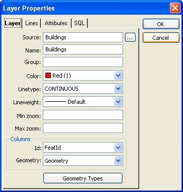
Source
Select which table to write/read to.
For each layer you have to select which attribute that is used as a unique id (to be able to update correctly to the database) and which attribute that represent the geometry.
SQL
For each layer you can also select a SQL query to for example filtrate on a certain attribute. WHERE OBJECT_ID='1'
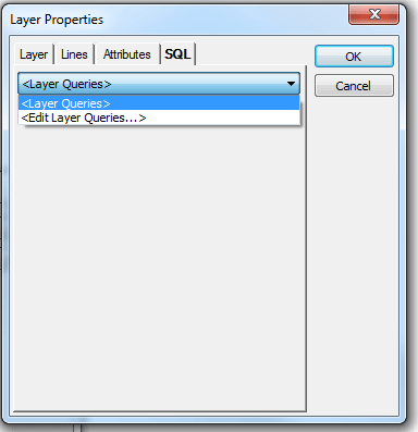
Select Edit Layer Queries... in the drop-down menu. The Define query dialogue will appear.
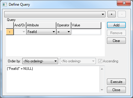
Click the Add button to Add a layer. The Define Query dialogue can also be reach from FDO|Add layer and the button Search.
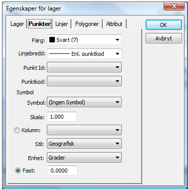
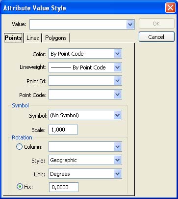
Points
Style settings for points. Note that all points imports as symbols to display attribute styles correctly.
Point id and point code refer to the connection between attributes and the points' properties, id and code.
A symbol can rotate after optional attribute or with fixed rotation.
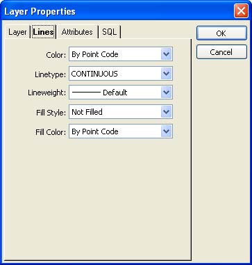
Line / polygon
Style settings for lines and polygons.
Attribute
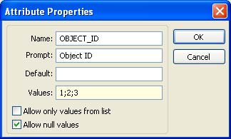
Configuration of which attributes that shall be added to each object in the layer.
For each attribute you can add an alias, name, standard value and a value list.
A value list is build by semicolon separated attribute values.
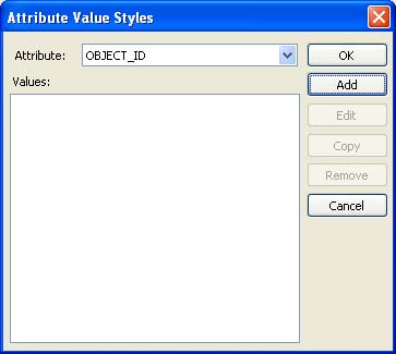
Styles via attribute values
Style setting can be connected to an attribute and then the layout of the object is depending on the value of the attribute.
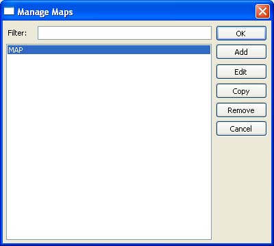
Manage maps
Configuration of which layers that will be included in a map, in which order they shall be read in and also map views valid for the map.
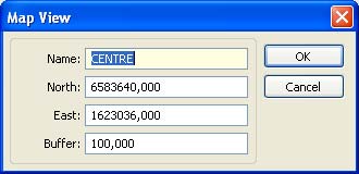
Manage map views
Configuration of global map views in which is used to open all maps. A map view contains of a centre point with a buffer which state height and width.
See more