Roadline - calculate points
Drawing|Geometry|Calculate
The Roadline/Points command calculates co-ordinates from files containing sections and offsets (orthogonal points). The calculated points are then used in the drawing.
To calculate co-ordinates from orthogonal points:
- Select or create the layer where you want the co-ordinates to appear.
- Select the command Calculate.
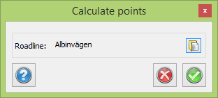
- Select the roadline by clicking the button ... If you have selected a roadline previously this will be the default selection. You can find a previously loaded roadline in the Roadline Manager or load a new one. This will activate the Roadline. You can close it straightaway and it will remain activated.
- Click on OK.
- The Open dialogue box appears. Select the co-ordinate file (.PXY) in which you have saved sections and offsets.
- Click on OK. The co-ordinates are imported into the drawing.
See also
Roadline for more information about the format of the roadline.