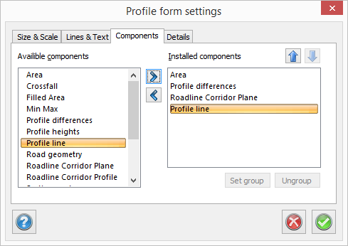
Profile form, components

The dialogue box contains two columns - the left-hand column shows available components and the right-hand column installed components. This is similar to the one used for survey data settings and text edit settings.
Data contained in profile form:
- Area
- Crossfall
- Filled Area
- Min max
- Profile differences
- Profile heights
- Profile line
- Road geometry
- Roadline Corridor Plan
- Roadline Corridor Profile
- Section markers
- Slope/Radius
- Tangent points
- Terrain heights
- Terrain profile
- User defined
You can add components you require by clicking on the header to the left and then clicking Add; alternatively you can double click. Note that the header/label remains on the left-hand side because it is possible to use several components of the same kind in the profile form. For example, is it possible to have several terrain profiles/sections for different roadlines or for different digital terrain models.
The order in which the components appear in the right-hand column is the order in the profile form.