WMS
Drawing|Misc|WMS
F unction to add a WMS (Web map service) as a layer.
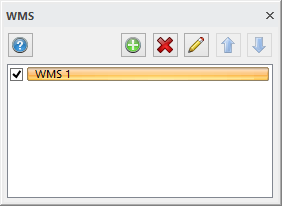
Turn on/off the layer in the dialogue.
If you do not already have a WMS service posted, click on the + to add a WMS service.
Then the settings dialogue appear.
Read more about in System Settings | WMS.
The arrows determines the order in which the images will be downloaded.
To add a WMS layers in a drawing:
1. Create a new layer in the drawing and name it WMS.
2. Select the layer in the Layer Properties Manager and click Edit.
3. Click the WMS and fill in the information as described under System Settings | WMS.