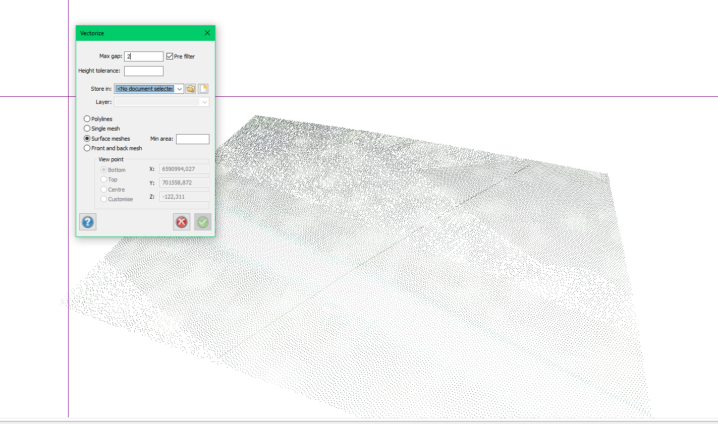
Vectorize
Point cloud|Vectorize
Vectorize the cloud into one or more mesh surfaces. This will become raster objects in a drawing. These can easily become terrain models with overhang or serve as a 3D image background in your drawing.
Pre filter- takes out loose points before starting the vectorization, this is recommended
Max gap: This set how far distance you will have between the points in the vectorized raster.
Height tolerance: Here you set how much rough the surface is, with a more narrow tolerance less verified surfaces will be found.
Store in: Choose a drawing to store output in
Layer: Choose layer in the drawing to store output.
Get output in one of the following formats.
Poly-lines
Single mesh. one mesh object in raster format
Surface meshes, this will be many mesh objects in raster format
Front and back mesh, this will be 2 meshes and aims to give two sides of the same object
Keywords: vectorize, surfaces, point cloud, find surface, meshes, vectorization