Field
Field
|
Function |
Description |
|
Select instrument and station establishment |
|
|
Measurement |
|
|
How to set out |
|
|
To work with road line reference |
|
|
How to work with GPS instrument |
|
|
|
|
|
Log to a file |
|
|
|
Field is an add-on module included in the base module, for connection to certain instruments, total stations, and GPS instrument directly into the drawing. The Field module makes it possible to follow the position directly in the drawing and mark points for survey and stake out.
Instrument
Select instrument under Settings in Topocad.ini. Choose between total stations Topcon AP-L1 and Geodimeter ATS series. For more information regarding settings for each instrument please contact Adtollo AB. The settings are different for different instruments.
Station
Select which station type you want to establish. Known station or free station.
Settings
Settings for this type of instrument.
Special
Special commands for this instrument.
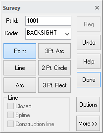
Survey
Function for measurement. Register for line or point. Set point ID, prism height and code.
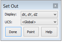
Set Out
Set out by marking a point in the drawing. Either co-ordinates or section/offset are displayed.
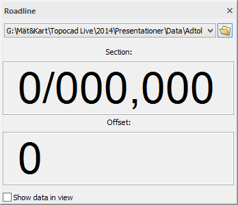
Road line
Usage of road line as reference. Section and offset are displayed continuously.
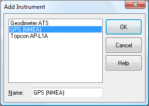
GPS
When having a GPS instrument, TopGPS is used as a software system between the GPS instrument and Topocad. This software system can transform co-ordinates interactive and Topocad reads the data directly. No more instrument connection is necessary. Please contact Adtollo AB for further information regarding TopGPS.
Settings for GPS
Go to Field | Instrument | Settings and the dialogue are displayed.
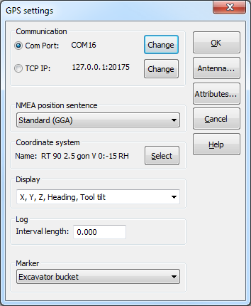
Communication
Com Port: The connected instrument is displayed here.
TCP IP: Specify a TCP IP to connect to instruments. Click change and a new dialogue opens. Localhost is the default. Change the IP address if needed.
Marker
It is possible to select the cursor to be plotted as a bucket. To show the bucket, the instrument must send an NMEA sentence of the type PDGGT, which gives information of the width and slope of the bucket.
NMEA position sentence
The position sets in the drop down list NMEA position sentence.
Standard (GGA)
Standard (GGA) sets the position in geodetical co-ordinates (latitude, longitude and ellipsoid height). Get the geocentric co-ordinates by transformation via Gtrans to an appropriate co-ordinate system.
Leica (LLK) and Trimble (PTNL,PJK)
Leica and Trimble sets the position in a north east direction and height. Transformation is not necessary.
Attribute settings
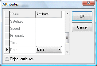
Matches different attributes for different GPS values. The attributes will be inserted at this attribute for every measured point.
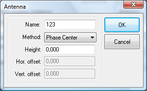
Select method.
Logging
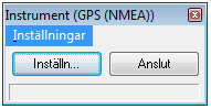
To start the logging, select Field|Instrument in the menu. Following dialogue appears. Select Options.
A new dialogue appears and you can select "Start logging to file". Select where to save the file. If nothing is selected, the file will not be saved.
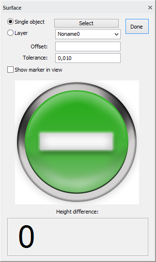
Surface
Select: Enter area by clicking Select.
Select single object or layer.
Offset: Select if you want to be, for example, one meter above or below.
Select tolerance.
Show marker in view: Optional if you want to display the marker.
The icon changes depending on whether you are too high, too low or within tolerance (as this image).
The figures at the bottom of the dialogue displays the difference in height in meters.