Modify raster in digital terrain model
DTM|Modify raster
Raster images can be imported into DTM documents just like Topocad drawings. In the DTM menu you find the command "Modify raster". A file dialogue appears when the command Modify raster is activated. Here you are able to import one or several images into the terrain model. If more than one file is selected will images with georeferenced data be inserted in the positions according to the georeferenced data. Remaining images will be inserted at origin. If only one file is selected a new dialogue appears.
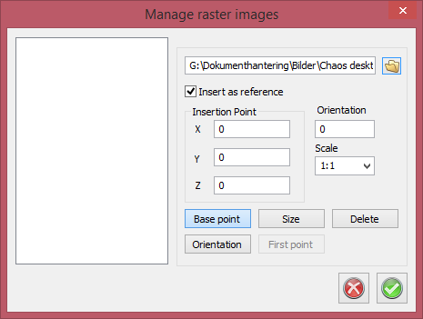
Enter the images position, orientation and scale. The data can either be typed in or by clicking the DTM view. The data will already be entered if georeferenced data is available for the file. If Insert as reference is checked, only the file name will be saved in the DTM file, or else the raster image will be included in the DTM and the file will require much more space.
Raster images inserted in a DTM document can be modified in the same command.
There is a list to the left of the dialogue, listing the raster images inserted in the DTM document. By selecting an image in the list, the position, orientation and scale is entered in the same way when a new image is inserted. It is also possible to delete raster images from the DTM document in this dialogue.